Your daily source of snow related goodness. Focusing on gear, fitness, lifestyle, weather, travel, adventures and technique!
View articles
Snow conditions
Californian Ski Area Explains Just How Much Work Goes Into Their Snow Data Measurements
Snow Forecast Mapswhere's the snow in the next 3 days?
Snow Forecast for 3300 ski resorts around the World, updated four times a day. Weather forecasts are provided for the top lift, bottom lift and mid-mountain elevations. Our detailed Snow Reports and live updates are submitted by local Ski Clubs, ski resort staff and our users. Interactive weather maps show the amount of predicted snowfall as well as the current snow conditions and weather observations. The snow maps also show where the best piste conditions, off-piste powder and forecast weather for skiing and snowboarding can be found.
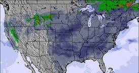
This map shows the accumulated snow forecast for the next 3 days. Click the image to view the interactive snow forecast map, or see a worldwide overview of all our maps that cover ski resorts for the Rest of the World.

Ski hire discount links
Typical extra 5% off online prices (10% for members):
Country ski resort overviews
- Andorra(9)
- France(185)
- Japan(315)
- Austria(316)
- Germany(198)
- Switzerland(211)
- Canada(122)
- Italy(215)
- USA(393)
- Argentina(15)
- Chile(20)
- New Zealand(30)
- Australia – New South Wales(4)
- Australia – Tasmania(2)
- Australia – Victoria(10)
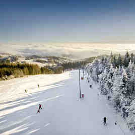
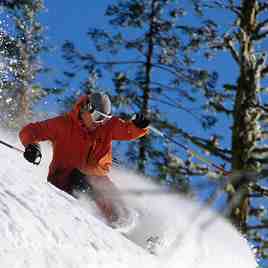
Photos from the gallery
Latest Snow News
-
 Snow falling at Klínovec.
-
 Light rain reported from Government Camp wx at 6053 feet one mile E of Timberline but it is forecast cold enough for snow at the ski area
-
Light rain reported from Oberdöbernitzen wx at 620 metres elevation 9 kms SSW of Weissbriach/Gitschtal but it is forecast cold enough for snow at the ski area
-
Light rain reported from Government Camp wx at 6053 feet one mile E of Timberline but it is forecast cold enough for snow at the ski area
Latest worldwide snow report
UPDATED 20 MARCH 2024| We are entering astronomical springtime (defined by the vernal equinox, the point when the Sun crosses the celestial equator and days start to become longer than nights, typically around March 20th or 21st in the Northern Hemisphere) and are already three weeks into meteorological springtime (which is based on the calendar and temperature cycle, encompassing March, April, and May for statistical consistency in climate data). In other words, we are in 'full spring,' with both the astronomical and meteorological seasons underway.....
Current ski resort picks
Long range skiing weather forecasts for daily picks of our top 5 Resorts are FREE to non snow-forecast.com members! Find the deepest snow, the snowiest forecasts and the ski resorts reporting powder conditions to make the most of planning your winter sports holiday.
Fresh Snow Depth
Powder reported
New snow in next 3 days
Latest submitted reviews
Les Deux Alpes ski resort:

“The latest reviews I'm seeing are from 2022. I've been working here for 30 years, and just don't recognise the resort in some of the comments. It's great for beginners most years (2024 is not one), with masses of skiing right in the village including up to red pistes, and I've taught off-piste lesson down there in the past.
For experienced skiers it's very good - lots of blacks, lots of accessible off-piste, and lots of variety. I would say that the 2-4 week skier might be a bit disappointed though. There is no 'travelling' to other resorts, and those who cannot change how they ski might easily be bored.
I can't speak about the snowpark as I don't do that, but it looks impressive!
Pisting is mostly pretty good, but the decision to stay with the more eco friendly cannons has not worked out this year, as temps have been mostly too high to run them.
SATA have taken over the running of the lifts and pistes, and it's been a welcome relief after several years of CDA taking out lifts, not replacing them, and clearly not giving a monkeys for the resort.
So, do come!”
Easiski from FRANCE - 07 Apr 2024
Sauze d'Oulx (Vialattea) ski resort:

“Just back from a late Easter week in Sauze. We got lucky with the snow after a few weeks of above average temperatures. Lovely tree lined runs with only the last bit bare and slushy. Made Sestriere over the top on a sunny day, which was a treat and some lovely skiing down to San Sicarso. Only gripe about this resort is the basic lift system which needs some investment. It’s crying out for a gondola from the village up to Sportinia to serve the beginners and when the low runs are suffering. I was in the 3valleys in January and the lifts are on another planet to Sauze. The 2 seater chair, which is the main Sestriere link lift, is a joke by modern standards. But, hey, the lift pass is a lot cheaper as long as you run at Italy speed and at 1.5 euros for a coffee on the slopes it makes for a cheaper holiday. Nice quick transfer from Turin also. The town itself is ok but not sure where the boozy reputation comes from. It was dead in the evening and a few quiet bars surviving and a few clubs looked like they’d closed down. Lacking ski in-ski out and there being steep hills to walk in ski boots is no fun,
To summarise, nice to go there, lovely red runs. But would I return? Probably not as all a bit dated and much better resorts to spend your time effort and money in.”
C roberts from UNITED KINGDOM - 02 Apr 2024
Read 65 more review(s) of Sauze d'Oulx (Vialattea) or submit your own
Saas Fee ski resort:

“Went here for two days because no snow in les Diablerets.
1. Very snow sure. Lots of runs above 2500 with good quality snow.
2. Trend to intermediates - there are a few itineraries but half were closed.
3. Lifts work ok, very little queuing.
4. Resort quite pretty with nice feel.
5. Expensive.
6. I imagine in early mid season the weather can often be too bad to go out but great fallback for reliable late season snow.”
Mike Saunders from UNITED KINGDOM - 18 Mar 2024
 Nearest