


View forecast
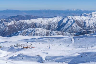
Waterville Valley at 553 m altitude
Issued by Snow-Forecast.com at: 1 pm (local time) / 13 May 2024
Now
Mon 13 | Tuesday 14 | Wednesday 15 | Thursday 16 | Friday 17 | Saturday 18 | Sunday 19 | ||||||||||||||
PM | night | AM | PM | night | AM | PM | night | AM | PM | night | AM | PM | night | AM | PM | night | AM | PM | night | |
cloudy | light rain | rain shwrs | mod. rain | heavy rain | light rain | mod. rain | mod. rain | light rain | rain shwrs | some clouds | some clouds | some clouds | cloudy | light rain | light rain | heavy rain | light rain | light rain | rain shwrs | |
km/h | ||||||||||||||||||||
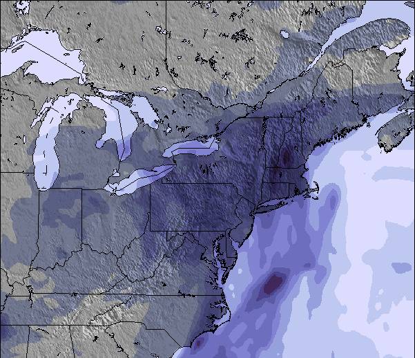
Snow map | 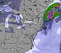 | 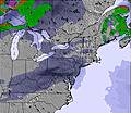 | 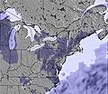 |  |  |  |  | |||||||||||||
— | — | — | — | — | — | — | — | — | — | — | — | — | — | — | — | — | — | — | — | |
— | 3 | 2.0 | 6 | 14 | 1.0 | 8 | 6 | 4 | 4 | — | — | — | — | 1.0 | 4 | 16 | 1.0 | 1.0 | 1.0 | |
max°C | 15 | 9 | 17 | 19 | 13 | 17 | 17 | 14 | 13 | 14 | 13 | 18 | 20 | 13 | 11 | 10 | 10 | 12 | 17 | 13 |
min°C | 15 | 9 | 12 | 16 | 11 | 13 | 15 | 12 | 13 | 13 | 11 | 14 | 19 | 8 | 11 | 10 | 9 | 10 | 15 | 11 |
15 | 7 | 10 | 16 | 10 | 13 | 15 | 12 | 13 | 13 | 11 | 14 | 19 | 6 | 9 | 8 | 8 | 10 | 15 | 11 | |
59 | 92 | 70 | 80 | 97 | 83 | 91 | 94 | 98 | 92 | 96 | 63 | 60 | 86 | 96 | 99 | 99 | 96 | 81 | 93 | |
2450 | 2800 | 2900 | 3100 | 3000 | 3050 | 3150 | 3050 | 3000 | 3100 | 3000 | 3000 | 3250 | 3550 | 3550 | 3100 | 3300 | 3750 | 3850 | 3750 | |
— | — | 5:20 | — | — | 5:18 | — | — | 5:18 | — | — | 5:16 | — | — | 5:16 | — | — | 5:15 | — | — | |
— | 8:02 | — | — | 8:04 | — | — | 8:06 | — | — | 8:07 | — | — | 8:07 | — | — | 8:08 | — | — | 8:09 | |
Next 0-3 days weather summary:
Heavy rain (total 44.0mm), heaviest during Tue night. Very mild (max 19°C on Tue afternoon, min 9°C on Mon night). Wind will be generally light.
Next 4-6 days weather summary:
Heavy rain (total 26.0mm), heaviest during Sat night. Warm (max 20°C on Fri afternoon, min 8°C on Fri night). Wind will be generally light.
Popular Waterville Valley Pages
Snow Radar
Submit a reportLatest snow reports near Waterville Valley:
40 km away from Waterville Valley
23 hours ago
Shower light snow reported from Mount Washington Airport at 4344 feet only 2 miles W of Wildcat Mountain but it is probably falling as rain apart from near the top of the ski area from Wildcat Mountain
Waterville Valley Snow Conditions
| Top snow depth: | — |
|---|---|
| Bottom snow depth: | — |
| Fresh snowfall depth: | — |
| Last snowfall: | 24 Apr 2024 |
| Snow Alerts | Create Alert |
Other resorts in USA - New Hampshire are reporting: powder (0) / good piste (0)
Snow-Forecast Partner Offers
Show your business here
Snow History
Week 2 of May has on average:
0.0 | Bluebird Powder days Fresh snow, mostly sunny, light wind. |
|---|---|
0.0 | Powder days Fresh snow, limited sun, any wind. |
0.0 | Bluebird days Average snow, mostly sunny, light wind. |
Waterville Valley Forecast Snowfall
Other resorts in USA - New Hampshire are reporting: powder (0) / good piste (0)
The above table gives the weather forecast for Waterville Valley at the specific elevation of 553 m. Our sophisticated weather models allow us to provide snow forecasts for the top, middle and bottom ski stations of Waterville Valley. To access the weather forecasts for the other elevations, use the tab navigation above the table. For a wider view of the weather, check out the Weather Map of United States.
Click here to read further information on freezing levels and how we forecast our temperatures.
Visitor Reviews of Waterville Valley
Overall 4.2 Based on 1 vote and 1 review
- Scenery
- Access
- Vote
- Con from United States writes:
Waterville Valley is one of the best family ski resorts I have ever visited. Trails are great cruisers on beautiful days and trails also offer plenty of steeps and moguls. The views are fantastic and the vertical drop is perfect. Waterville is perhaps one of the best deals in New Hampshire. Take advantage of the threedom pass for season passes. Waterville Valley makes winter come alive!
Visitor Reviews of Waterville Valley
Con from United States writes:
Waterville Valley is one of the best family ski resorts I have ever visited. Trails are great cruisers on beautiful days and trails also offer plenty of steeps and moguls. The views are fantastic and the vertical drop is perfect. Waterville is perhaps one of the best deals in New Hampshire. Take advantage of the threedom pass for season passes. Waterville Valley makes winter come alive!
Free Snow-Forecast.com weather widget for your website
The Waterville Valley skiing weather widget is available to embed on external websites free of charge. It provides a daily summary of our Waterville Valley snow forecast and current weather conditions. Simply go to the feed configuration page and follow the 3 simple steps to grab the custom html code snippet and paste it into your own site. You can choose the snow forecast elevation (summit, mid-mountain or bottom lift) and metric/imperial units for the snow forecast feed to suit your own website…. Click here to get the code.
View detailed snow forecast for Waterville Valley at:
snow-forecast.com

 Nearest