Europe Weekly Roundup #236
(Updated 10 April 2024) A comprehensive review of snow conditions, weather, and updates for Europe's winter sports destinations.
From Powder to Sunshine: Ski Resorts Worldwide Navigate Spring's Rollercoaster
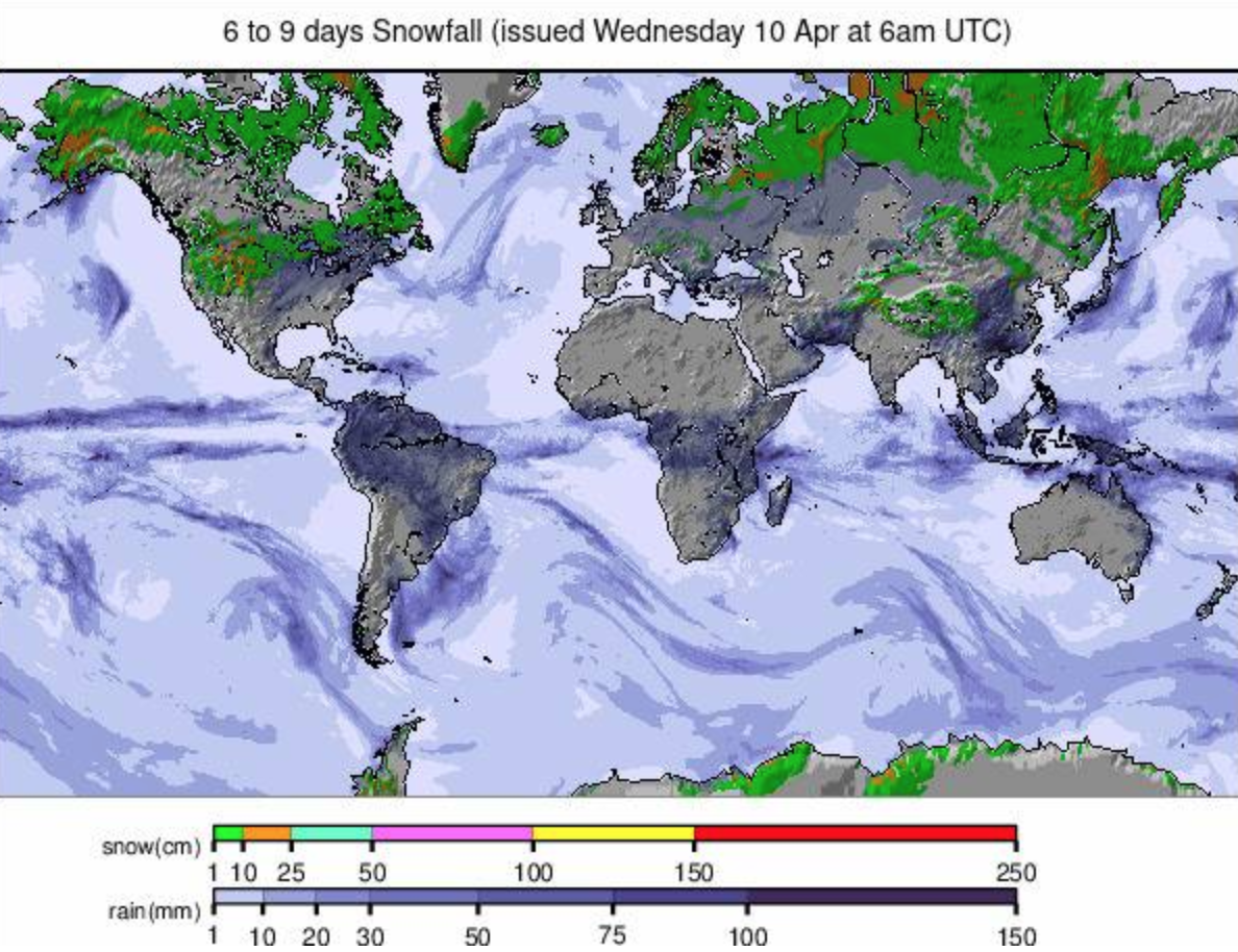
- Global Snowfall: North American ski areas, particularly in the North and East, have experienced significant snowfalls, while Europe and Japan transition to spring conditions after Easter snowfalls.
- Continued Skiing: Despite many closures, several hundred ski centers across Europe, North America, and Asia will remain open into the latter half of April, and some into May.
- Southern Hemisphere: Ski areas in the Southern Hemisphere are gearing up for the 2024 season, with early autumn snowfalls reported in South America and Australia.
WORLD OVERVIEW
North American ski areas, particularly in the North and East, have reported some of the biggest snowfalls of the past week, with some centers getting another few feet (60cm) over the last seven days. In Europe and Japan though, things have turned much more spring-like with warm, sunny weather reported after the big snowfalls reported over Easter week. That said, both areas have reported some snowfall in the last 24 hours. As we move deeper into April, many more of the northern hemisphere’s ski centers are ending their seasons. We saw more big-name resorts close at the end of last Sunday’s ski day, and next Sunday, the 14th, will see many more. However, several hundred European, North American, and Asian centers will remain open into the latter half of the month, and a good many into May.
At the same time, of course, the Southern hemisphere’s 2024 ski season draws ever closer, and more centers have been reporting early autumn/fall snowfalls there, most recently a decent dump down to resort level for ski areas in the South American Andes with Australian resorts reporting 10cm (4”) or so on Tuesday, April 9th too.
EUROPE
EUROPE INTRO
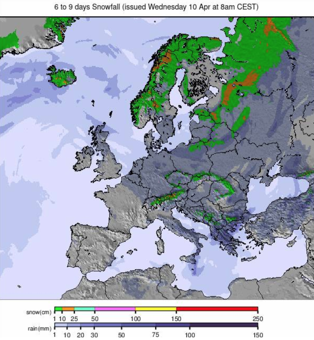
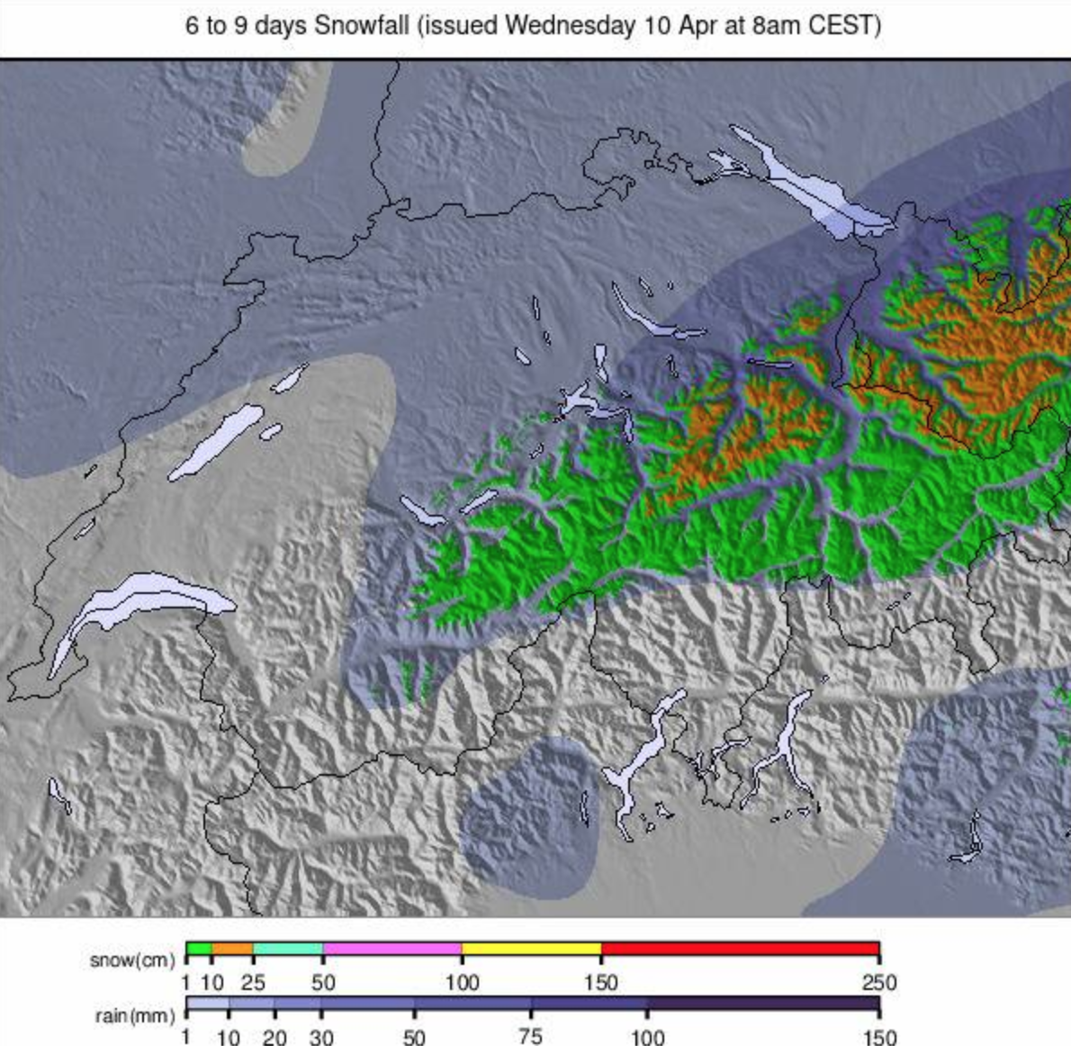
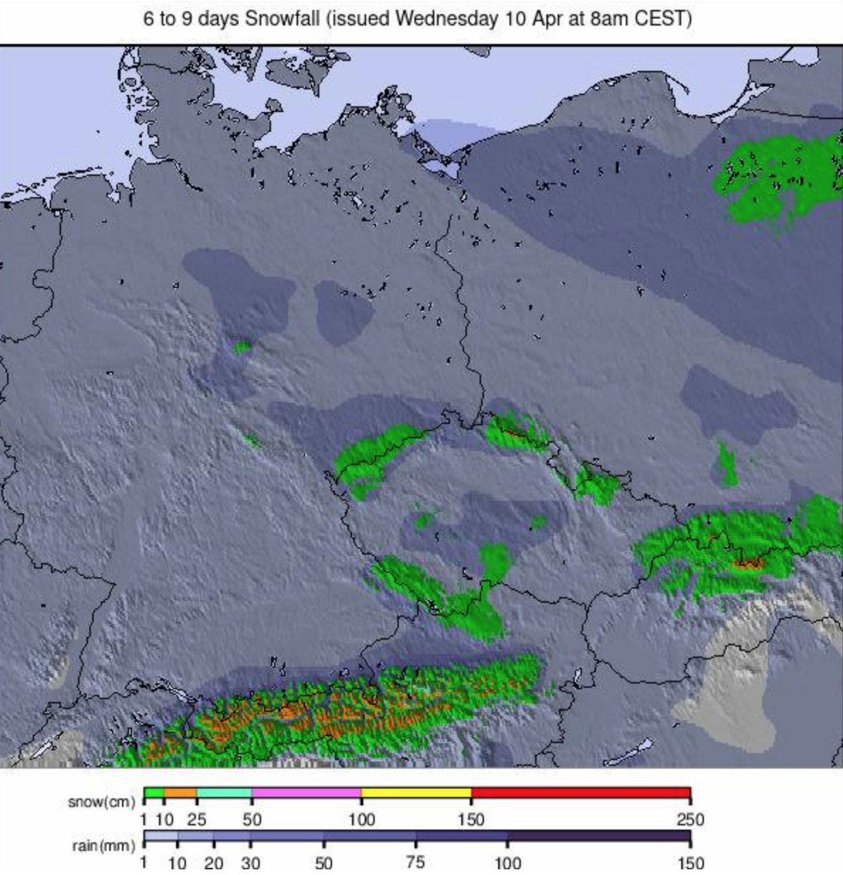
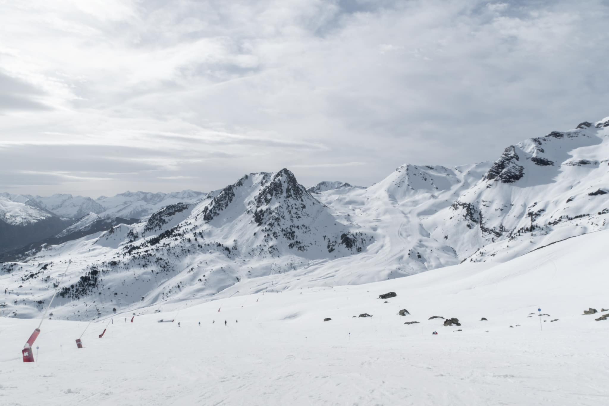
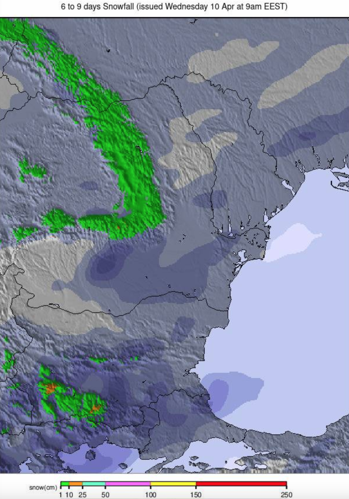
There's been quite a change in the Alps over the last seven days, with things still feeling quite wintry as we completed last week's report after big snowfalls across much of the continent during Easter week. But then, in the past five days, skies have cleared, sunshine returned, and temperatures climbed 10-20 degrees for more usual spring conditions and a return of the thaw. Temperatures at 1,000m in some Alpine valleys shot up to +25C! Before it took hold though, Easter week snowfalls surpassed 2 meters (80 inches) for some resorts. The heavy snowfalls, coupled with strong winds, set avalanche danger up to high levels and bases at several Swiss resorts reached the deepest reported anywhere in the world this season at over 5.5 meters (approximately 18 feet). Those have now fallen back down with the warm temperatures though so it appears that was the apex of 23-24 season snow depths. Elsewhere in Europe, temperatures have been rising too in Scandinavia but have not reached the heights of the Alps; it's been warm in much of eastern Europe and down in the Iberian peninsula, and Scotland has had a mix of warm temperatures and heavy snow showers.
AUSTRIA REPORT
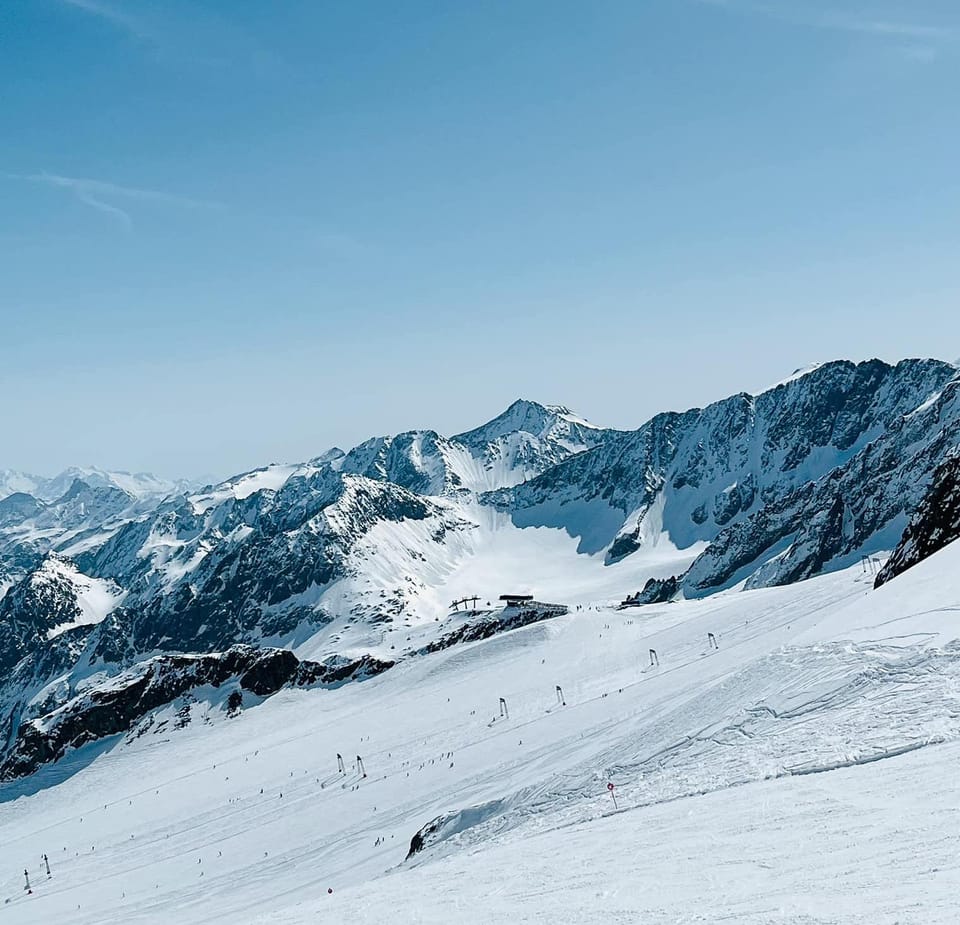
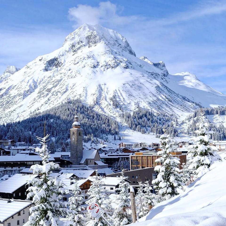
Higher slopes in Austria have seen more snowfall over the last week, although these are increasingly falling as rain and sleet lower down and for most Austrian areas, the weekend and start of this week were dry and sunny with temperatures reaching +20C in some alpine valleys. The Silvretta area was one of the big winners, reporting over 30cm (a foot) of fresh snowfall at the end of last week; there was also significant snowfall for the Arlberg (Lech and St Anton) (35/400cm / 14/160”) as well as Serfaus Fiss Ladis reported. There are currently 20 ski areas in the world posting more than a 4m (160”) upper slope base and about a third of these are in Austria, most of them glacier centers open into May or even June.
AUSTRIA FORECAST
A mix of sunny spells with rain, sleet, or snow showers through the remainder of the week, the precipitation type dependent mostly on altitude and time of day/night. Mostly rain though with temperatures in the -5 to +15C range, so a little cooler than it has been recently.
SWITZERLAND REPORT
Swiss ski resorts are currently posting the deepest snow depths in the world having hit new season highs last week. It has kept snowing, and higher slope bases have kept building as we move further into April – something that happened last spring too, but previously world snow depths usually peaked in early March. Saas Fee (75/500cm / 30/200”) peaked with a 580cm (232”) base after Easter, the deepest reported in the world this season, although it has now dropped back and fallen behind Laax (0/505cm / 0/202”). After the big snowfalls over Easter and the gale-force winds, the past three or four days have been much calmer with warmer temperatures – as high as +20C in some Swiss alpine valleys, and lots of sunshine.
SWITZERLAND FORECAST
Continuing warmer and drier than it has been overall, but several fronts moving through will bring showers, potentially heavy in some areas, and potentially snow on higher slopes.
FRANCE REPORT
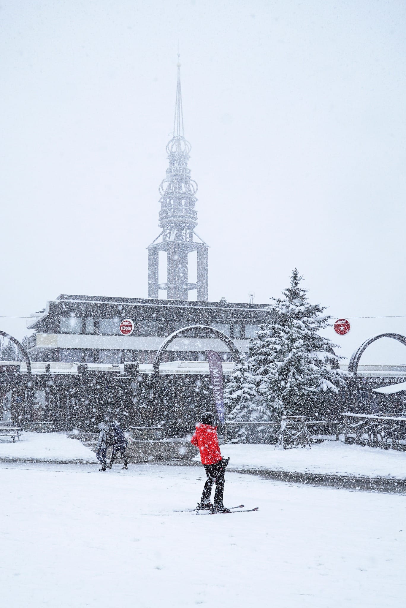
After the heavy snowfall in the French Alps around the Easter weekend, temperatures have risen a good deal, skies cleared, sunshine returned, and everything feels much more springlike. So much so valley temperatures reached the +20s Celsius at the weekend and start of this week and even at 3,000m we saw +5C, although temperatures were still dropping below freezing overnight at the altitude at least and snowfall was reported again in the 3 Valleys on Tuesday, April 9th above about 1500m. France has more ski areas staying open at least to the middle of April than any other Alpine nation – around 40 centers in total. However, some big names including Megève/Saint-Gervais and even Risoul and Vars which saw two meters of snowfall in the week up to Easter ended their seasons last weekend.
FRANCE FORECAST
The warmer temperatures are set to ease slightly but remain close to seasonal norms, delivering freeze-thaw conditions on higher slopes, mostly remaining above freezing around the clock now in valleys, highs there around +12C in the afternoons. Plenty of sunshine but fronts moving through will bring rain/sleet and possibly snowfall at altitude.
ITALY REPORT
After the last of the Easter-week snowfalls cleared last Thursday, it's been warm and sunny for much of the past week across Italian ski regions with daytime valley highs reaching +25C down at 1,000m – clearly not good news for low-level snow. Even at altitude temperatures climbed well above freezing. Some of Italy's bigger and best-known ski areas including Alta Badia and Val Gardena ended their seasons on Sunday, but a dozen more will continue into the latter half of this month with some including Cortina (35/150cm / 14/60”), currently still 100% open Livigno (80/203cm / 32/81”) and Cervinia (5/200cm / 2/80”) planning to keep skiing into May (and now year-round up on the glacier shared with Zermatt in Cervinia’s case).
ITALY FORECAST
A largely sunny forecast continues for much of the country, possibly slightly cooler than the highs we saw at the weekend and earlier this week but still reaching the high teens in valleys and the freezing point moving up above 3,000m.
GERMANY REPORT
Most of the dozen or so German ski areas that had struggled on through a poor snowfall winter to the start of April closed their slopes after the Easter holidays week on Sunday. However, two remain with limited terrain available on high slopes and both are aiming to remain open until May 1st. Two of Oberstdorf’s sectors at Fellhorn and Söllereck closed on Sunday but the Nebelhorn (10/200cm / 4/80”) has about 10km of slopes open up high. The same is true for Germany’s highest slopes on the Zugspitze Glacier (145/311cm / 58/125”). Valley temperatures have reached +25C this week and even at 200-0m, we’ve seen over +10C so the snow is melting, but should make it through the final three weeks of the season here.
GERMANY FORECAST
The forecast is for, belatedly, some colder weather and light snow showers to end the week, although it won’t be cold enough for snow down to valley floors, so rain down low, snow up high.
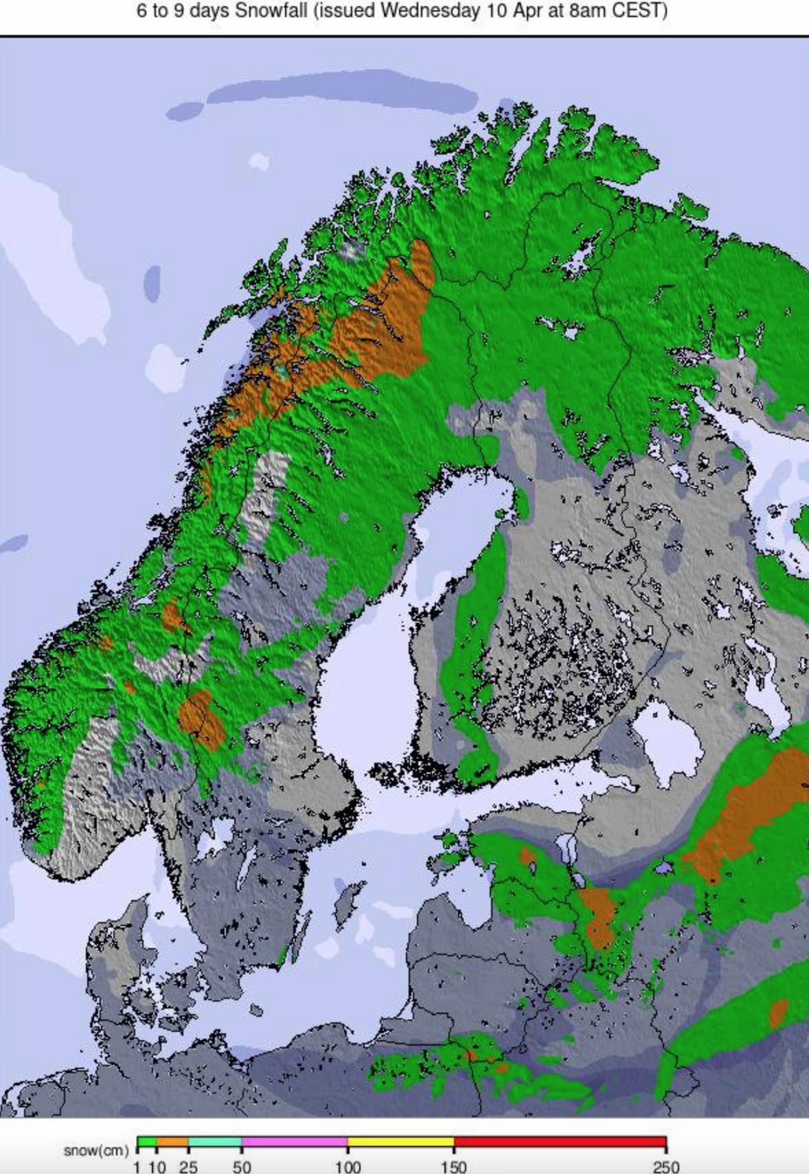
SCANDINAVIA REPORT
Quite a mixed week for weather across Scandinavia with some light snow showers reported and temperatures still dipping to double digits below freezing at times – quite frequently in the north, just occasionally down towards the more populated areas like Lillehammer, Oslo, and Bergen in the south, where we're into more of a freeze-thaw scenario most days now. Some of these more southerly centers like Tryvann near Oslo and Hafjell near Lillehammer are ending their season this weekend but the larger destination resorts and those up in the north like Finnish Lapland will remain open into May. Myrkdalen (120/225cm / 48/90”) near Voss is posting the region’s deepest snow, Sweden’s Are (60/115cm / 24/46”) the most open terrain.
SCANDINAVIA FORECAST
Mostly dry weather with some light snow showers, temperatures ranging from -8 to +8C in the southern half of Scandinavia, so freeze-thaw conditions, still mostly below freezing up towards the Arctic Circle.
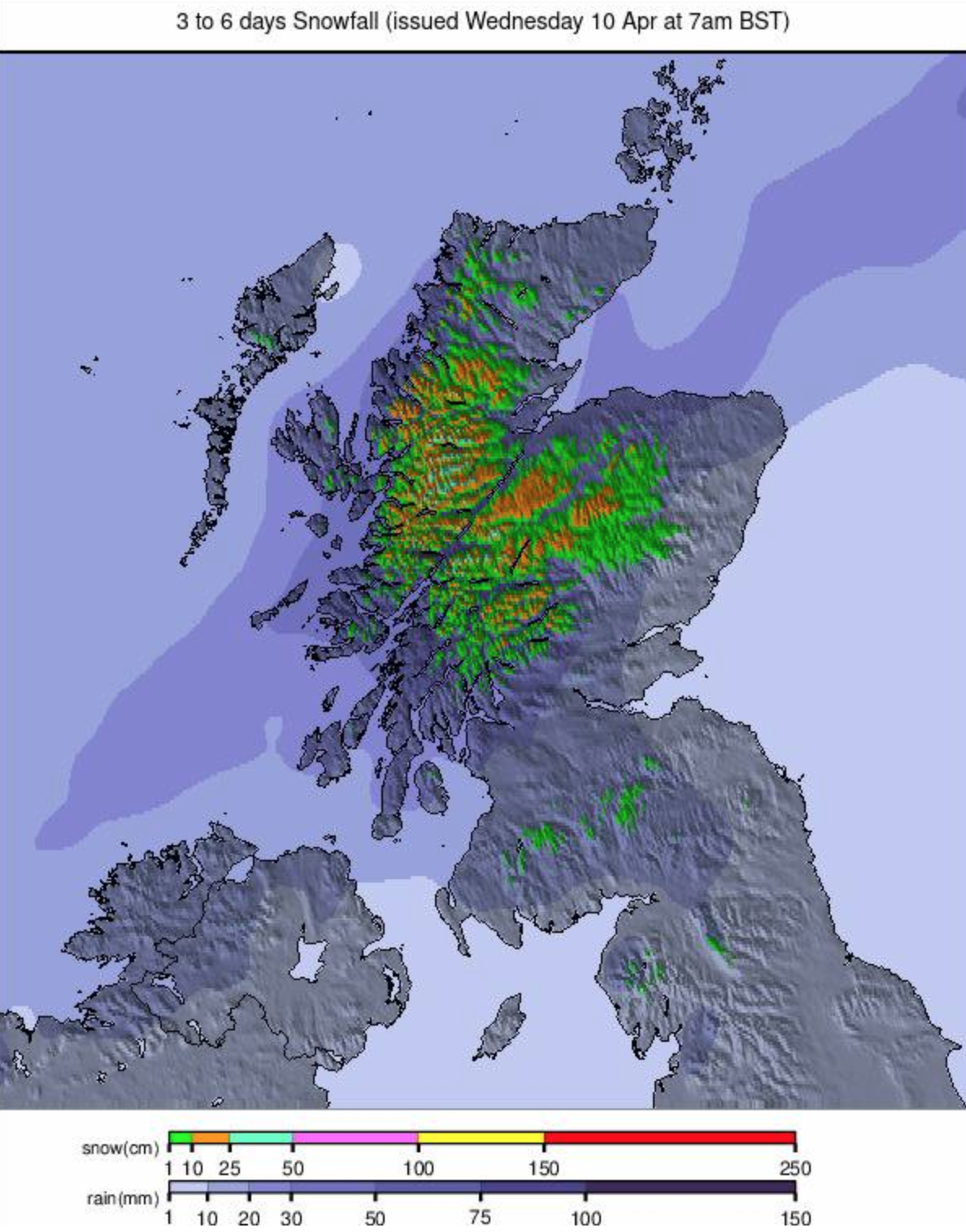
SCOTLAND REPORT
Scotland has had its usual mix of weather with some good April snowfalls bolstering bases even at lower levels on Friday, for example, but followed by gales and temperatures in those valleys shooting up to +15C 24 hours later on Saturday. That was as storm Kathleen blew through, closing lifts anyway. The season now appears just about over. Cairngorm hasn’t said it is but says its lower SnowFactory 'all-weather snowmaking maintained beginner area' has broken up and will no longer be maintained at that. The warm, stormy weather means its unlikely upper slopes will reopen either - they last operated on Friday last week. Glencoe says its inbounds terrain is no longer complete either but is running its access chair for ski tourers to get a lift up to fresh snow outwith its designated area. Glenshee and The Lecht have now closed for snowsports for the season and Nevis Range has none available either.
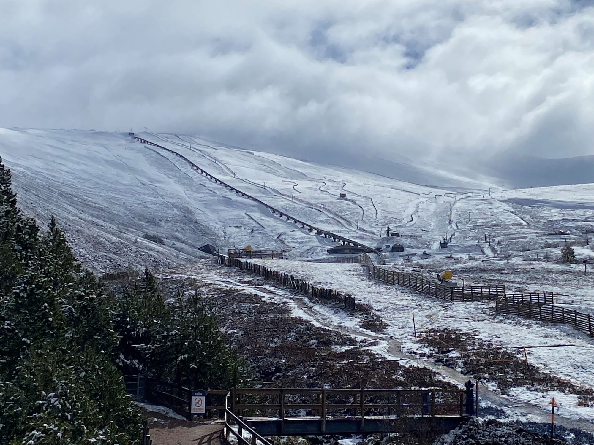
SCOTLAND FORECAST
Scotland’s standard weather mix for the week ahead with rain, sleet, and snow forecast, mostly dependent on altitude. Temperatures dipping below freezing overnights on mountain tops but more often in the +5 to +10C range. Sunny spells between showers.
SPAIN / ANDORRA REPORT
The vast majority of ski areas in the Pyrenees have now closed for the season with big resorts like Baqueira Beret and Formigal in Spain closing last weekend along with the greater part of the region’s biggest resort, Grandvalira in Andorra. However, some slopes remain open in the Andorran, French and Spanish Pyrenees until the end of this coming weekend, or the one after. Andorra’s freeride center of Ordino Arcalis (180/210cm / 72/84”) is open until Sunday, with France’s Cauterets (40/140cm / 16/56”) and Spain’s Masella (20/70cm / 8/28”) both shooting for at least the 21st (Masella hasn’t officially named the day yet). Sierra Nevada, Europe’s most southerly area, also keeps operating down by the Med coast. As to the weather, the snowfall petered out, and temperatures rose in the latter half of last week and have stayed warm and predominantly sunny since.
SPAIN / ANDORRA FORECAST
Although a front has been moving through bringing colder temperatures and precipitation for some, that’s expected to move through quickly and we’re returning to mostly sunny skies and warm temperatures.
BULGARIA / ROMANIA REPORT
With most of Bulgaria and Romania’s ski areas closing early last week due to exceptionally warm temperatures credited to warm air moving up from the Sahara, Bansko (0/100cm / 0/40”) is the only ski area still open, although due to close its season after the coming weekend. Its snowpack is thinning, and obviously conditions in its final week of the season are best first thing in the morning but it’s holding up to the sunny onslaught so far and has about a third of its terrain, on the upper mountain, still open.
BULGARIA / ROMANIA FORECAST
No real respite from the heat and sunshine, just a weak front moving through possibly bringing a few snowflakes up high, but more likely rain.
CZECH REPUBLIC / SLOVAKIA REPORT
It was colder and snowier in Slovakia last week than had been the case since mid-March, with the region’s largest resort, Jasna (30/60cm / 12/24”) reporting a 20cm (8”) accumulation before temperatures rose (as high as +20C in valleys) and skies cleared. The resort does expect to keep operating through into May though, at least on its higher slopes, currently about a third of its terrain remains open. With Tatranská Lomnica (40/80cm / 16/32”) and Štrbské Pleso (40/50cm / 16/20”) both planning to end their season this coming weekend, it looks like it’ll be the only major center open in the region from Monday. All centers in the Czech Republic closed down for the season last week.
CZECH REPUBLIC / SLOVAKIA FORECAST
It is expected to be a little cooler in the latter half of this week than the first half with some precipitation forecast but with daytime highs still getting into double figures and plenty more sunshine between the rain/sleet/snow showers there’s no last-minute respite on spring’s onslaught expected.