North America Weekly Roundup #236
(Updated 10 April 2024) A comprehensive review of snow conditions, weather, and updates for North America's winter sports destinations.
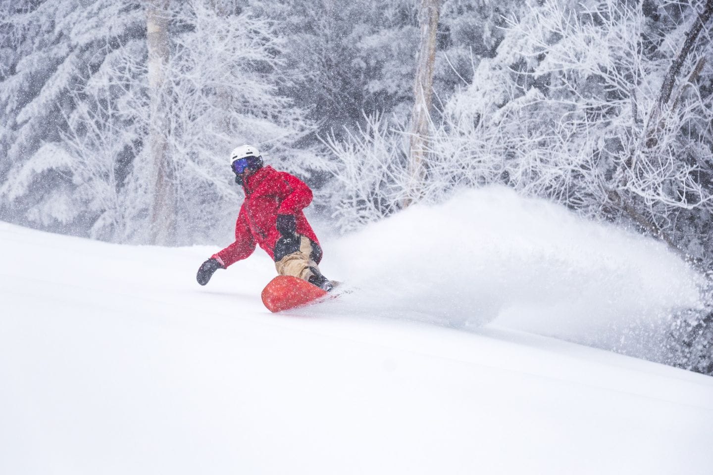
Powder Alert: East Coast Snow Delivers Late-Season Skiing Delight in New York and Vermont
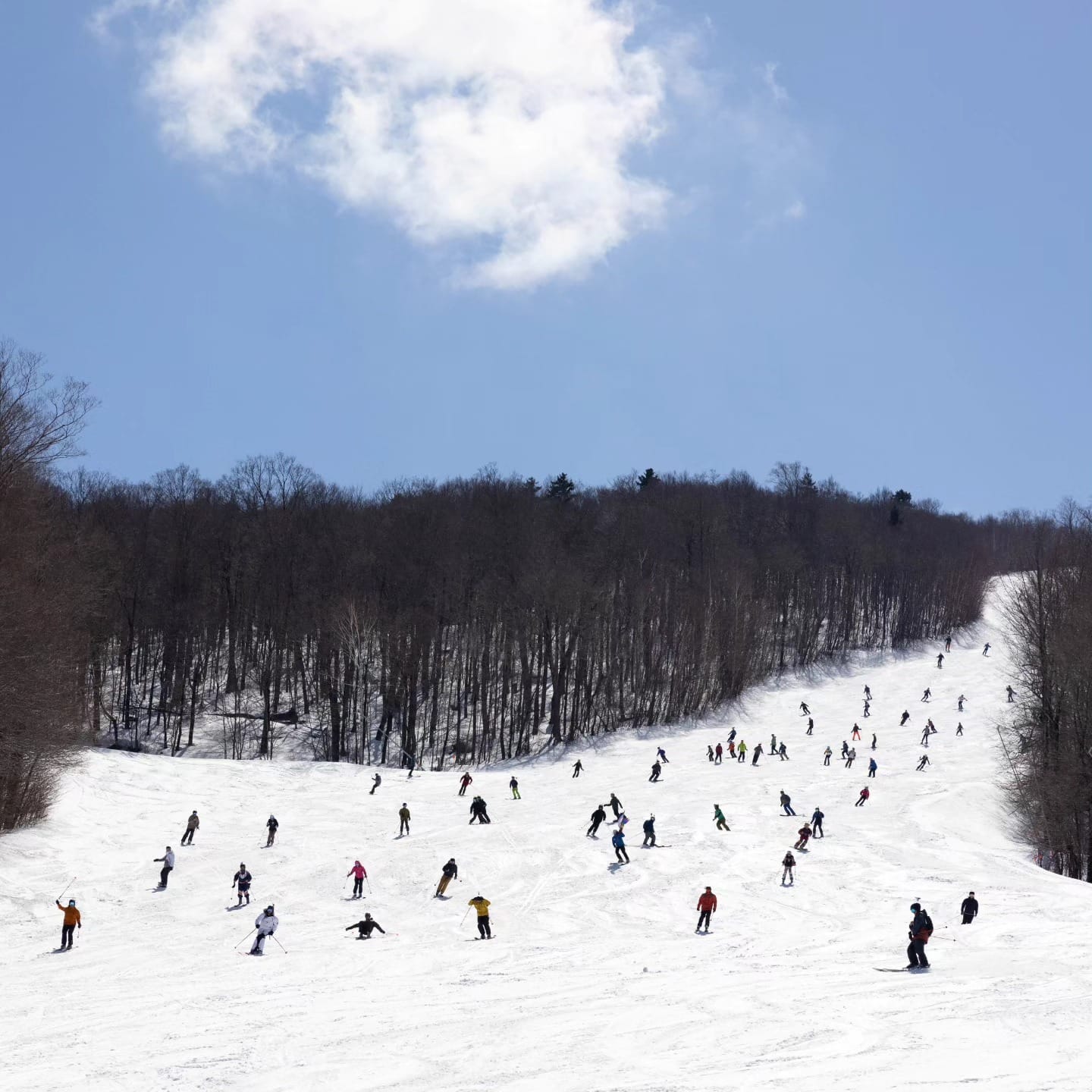
- North American Closing Dates: Ski areas in North America are gradually closing, with some extending their seasons into May, offering a mix of spring skiing conditions.
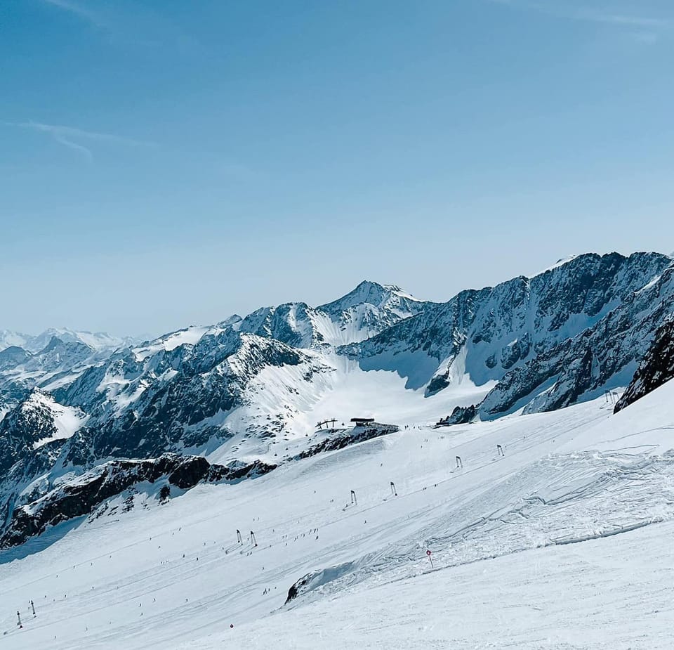
- Rockies Conditions: About 30 ski areas in the Rockies are still open, enjoying predominantly sunny weather with classic spring skiing conditions.
- East Coast Snowfall: The East Coast experienced heavy snowfall, with accumulations reported in states like New York and Vermont, providing excellent late-season skiing opportunities.
NORTH AMERICA INTRO
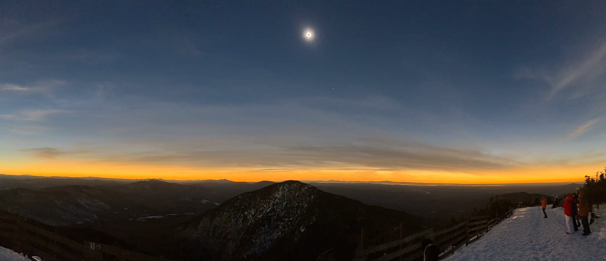
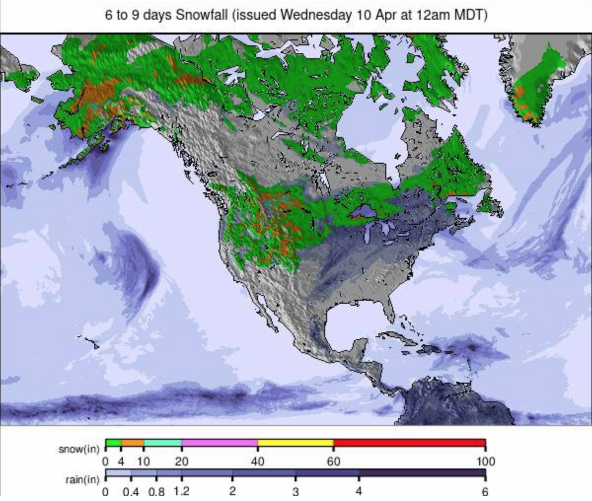
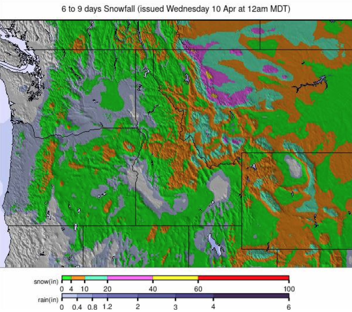
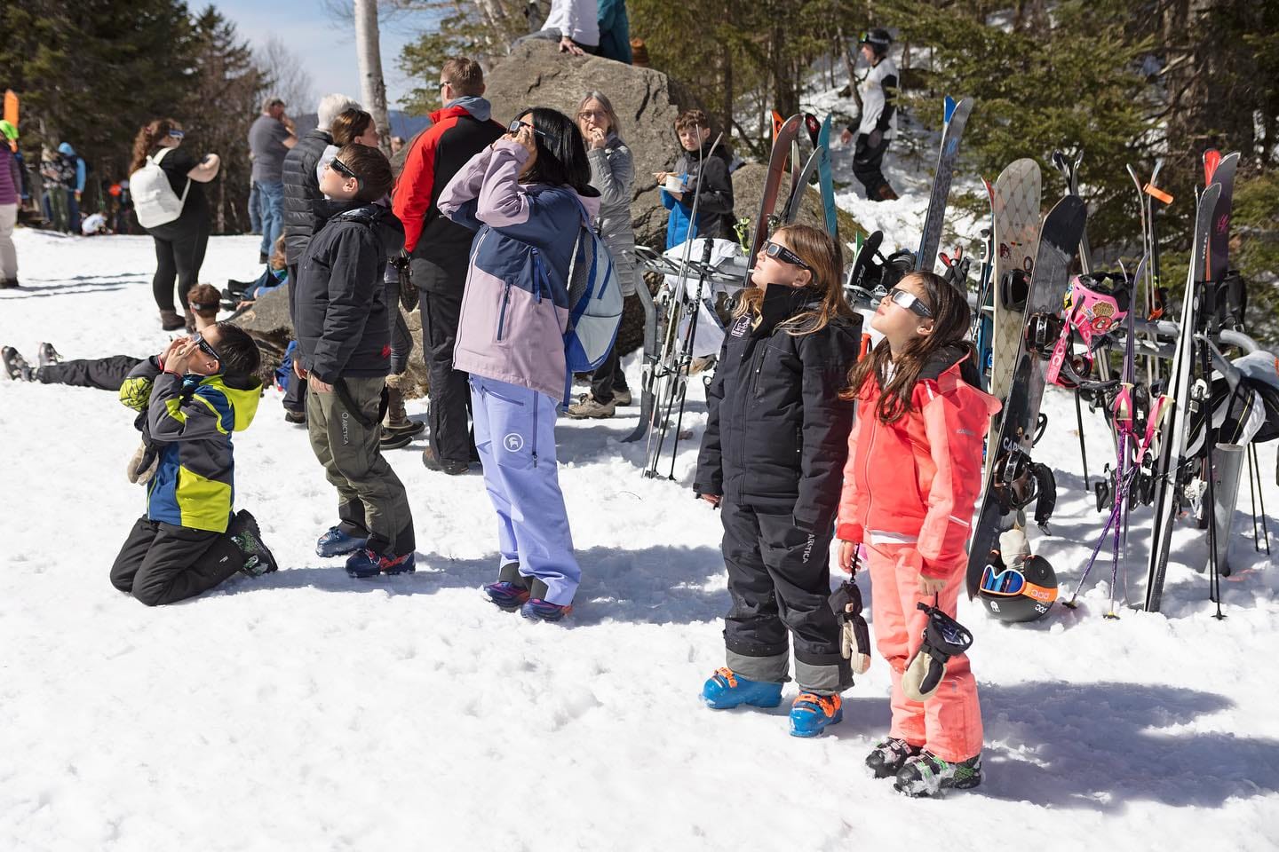
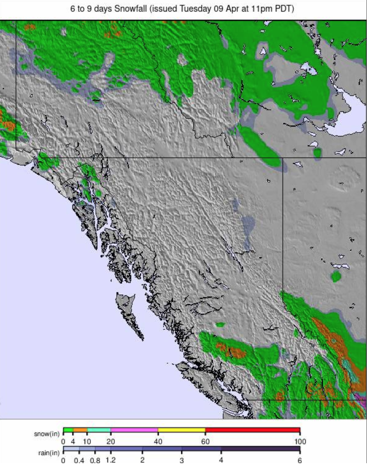
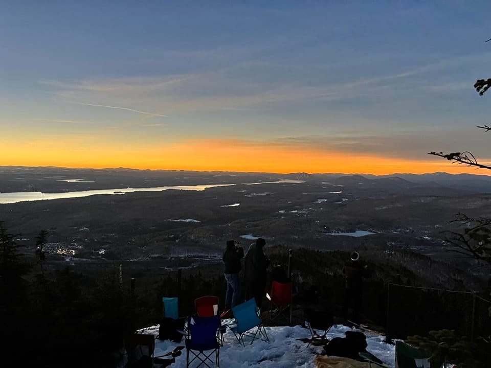
An East/West divide in the US this past week, at least up to the weekend with wintry weather in the East and accumulations of up to 40 inches (a meter) reported between Tuesday and Sunday in states like New York and Vermont. In the Rockies and on the West Coast, by contrast, there have been mostly clear skies and just some light to moderate snow showers, at least in the US West that is, further north in Alberta and BC there were some more significant snow bringing up to 40cm of fresh snowfall on high slopes in the last 7 days to Western Canadian slopes. Fortunately, the clear skies arrived in the Northeast in time for the solar eclipse on Monday afternoon. There are currently more North American resorts planning to stay open into May, even late May, than there are in Europe with a growing number announcing extended seasons.
ROCKIES REPORT
About 30 ski areas are still open in the Rockies, and most have enjoyed a predominantly sunny week, with classic spring skiing conditions and just the odd light snow shower reported. However, with Jackson Hole (32/109" / 81/277cm) and Big Sky (40/53") 101/138cm) planning to end their seasons on Sunday, the 20 or so areas in the region open for the latter half of the month are all in either Colorado or Utah, at least in terms of the big-name destination resorts. Park City (108/108” / 270/270cm) continues to post America’s biggest ski area as fully open still and plans to remain open another week to the 22nd of April having extended its season. Fellow Utah area Alta (50/165" / 125/412) has the region's deepest reported snowpack.
ROCKIES FORECAST
Mostly sunny again for the week ahead. Higher slopes should still see temperatures dip 5-10 degrees below freezing overnight, but daytime highs at the resort level are likely to reach the high 40s and into the 50s.
USA WEST REPORT
It has been a mostly dry and often sunny week in the west, with temperatures ranging from the low 20s to the high 40s Fahrenheit through the 24-hour cycle depending on altitude. This has driven predominantly freeze-thaw conditions and typical spring skiing conditions. Mammoth Mountain (125/177” / 312/444cm), Timberline (114/170” / 285/425cm), and The Palisades (39/164" / 97/419) continue to post the region and North America's three deepest snow depths and all three are open at least to the end of May. Crystal Mountain in Washington state and Mt Bachelor in Oregon also plan to start opening into May, although in their cases, so far, only to the start of the month.
USA WEST FORECAST
Mostly sunny weather continues for the week ahead. Daytime highs get into the low 50s Fahrenheit at resort level, upper slopes getting close to the freezing point overnight, but sometimes staying above that now, daytime highs up high in the 40sF.
MIDWEST REPORT
It’s the final week of the season in the Midwest, and just two areas remain open, both in Michigan, to this coming weekend when both plan to close. Boyne Mountain (30/30” / 75/75cm) has about 20% of its terrain open on the upper mountain and it’s a similar story at Snowriver (12/30” / 30/75”). There have been some sleet and even light snow showers up high, as well as rain and there was a band of heavier snowfall moved through late last week, but temperatures are getting into the 50s in the daytime so the cover is going fast.

MIDWEST FORECAST
Increasingly mild in the daytime and overnight lows not getting below freezing anymore so the thaw has really set in.
USA EAST REPORT
A storm that brought snowfall across the US was felt on the East Coast too with accumulations of heavy wet snow on higher slopes of up to 18” (45cm) was reported at some areas in 72 hours, with Vermont’s Jay Peak posting 36” (90cm) through the week. That arrived just before the solar eclipse passed through the region on Monday afternoon. The snowfall eased through the weekend, and there was some sunshine to start the week. Of the region’s larger ski areas, about 10 remain open at least to the coming weekend with Sugarloaf (35/70cm / 14/28”), Sunday River (28/32” / 70/80cm), and Killington (8/20” / 20/50cm) among the areas saying they’ll continue into the latter half of the month, possibly into May in some cases. Most ski areas in New Hampshire are now closed though.
USA EAST FORECAST
More precipitation is expected in the latter half of this week, but with temperatures rising into the 40s and low 50s it seems likely this will be rain rather than snowfall for most, although it may be snow in the highest slopes. Either way, it's expected to be light.
CANADA
CANADA WEST REPORT
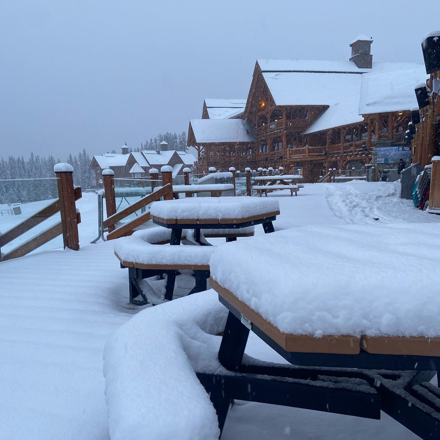
A few of Canada's big-name ski areas closed at the weekend, including Silver Star and Sun Peaks, and we’re into the final few days for more including Kicking Horse (70/163cm / 28/65”), Panorama (33/111cm / 13/44”), Revelstoke (105/190cm / 42/76”), and Fernie (118/243cm / 49/97”) and Big White. Most of the half-dozen remaining open from next Monday though, including Banff’s Sunshine and Lake Louise (70/155cm / 28/62”), Jasper’s Marmot Basin (106/106cm / 42/42”) and of course Whistler Blackcomb (0/220cm / 0/88”), will stay open into May, several (Sunshine and Whistler) for another six weeks to near the end of next month. Whether closing this weekend or not, most ski areas across Canada have had a snowy week with 7-day accumulations of up to 60cm (2 feet) reported on higher slopes. Lake Louise posted a 42cm accumulation there. OK, it's often been heavier, wetter slope than ideal but we are in the final days of the season for most. The weather has turned drier and sunnier since the latter half of the weekend.

CANADA WEST FORECAST
Continuing dry and often sunny, temperatures mostly above freezing now even overnight on higher slopes, though still subzero up high in the small hours some nights. Lows otherwise around +1 or +2C, afternoon valley highs +11 or +12C. Showers in the latter half of the week are most likely to be rain now, not snow, unless centers get very lucky.
CANADA EAST REPORT
The coming weekend is expected to be the last of the season for many of the ski areas still open in Eastern Canada, including the largest, Mont Tremblant (0/140cm / 0/56”), which is currently posting both the deepest snowpack up top and the most terrain open (about half of its full area). However, Sommet Saint-Sauveur (55/95cm / 22/38"), currently opening at weekends only, has a reputation for keeping some high terrain on its north-facing slopes open into May each year, and the region's second-largest ski area Mont-Sainte-Anne (70/95cm / 28/38") is currently planning to keep operating until the 21st. However, Le Massif (70/105cm / 28/42") and Ontario's Blue Mountain Resort (50/65cm / 20/26"), the latter currently operating Friday to Sunday only, plans to close at the end of the ski day on Sunday. The past week has seen light snowfalls clear to sunny skies and temperatures climb from a -5 to +5C range giving freeze-thaw conditions to 0 to +12C springlike weather.
CANADA EAST FORECAST
Mostly dry weather but with some rain showers, potentially falling as snow on higher slopes. Temperatures in the -2 to +12C range.