


View forecast
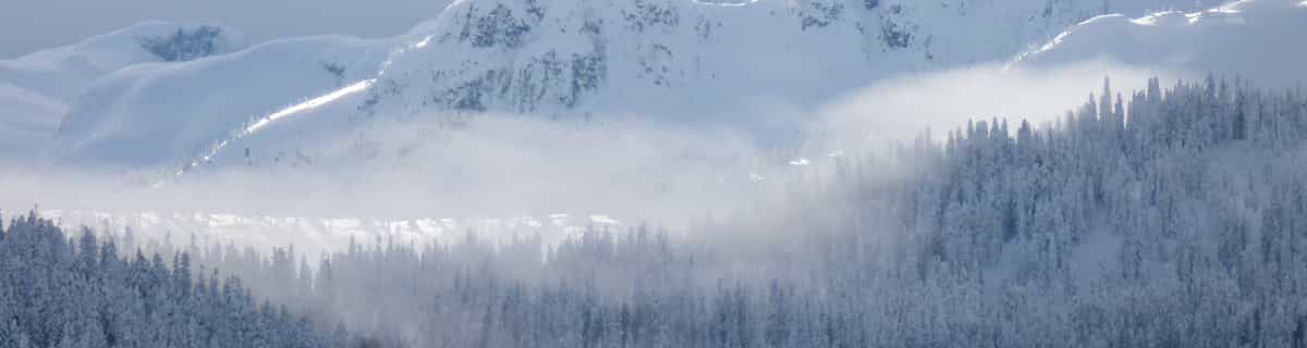
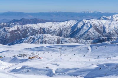
Klewenalp - Stockhütte at 2324 m altitude
Issued by Snow-Forecast.com at: 7 am (local time) / 16 May 2024
Now
Thursday 16 | Friday 17 | Saturday 18 | Sunday 19 | Monday 20 | Tuesday 21 | Wednesday 22 | |||||||||||||||
AM | PM | night | AM | PM | night | AM | PM | night | AM | PM | night | AM | PM | night | AM | PM | night | AM | PM | night | |
snow shwrs | light snow | mod. snow | light snow | snow shwrs | rain shwrs | clear | risk thun- der | snow shwrs | clear | risk thun- der | rain shwrs | some clouds | risk thun- der | heavy rain | heavy rain | mod. rain | light snow | light snow | light snow | light snow | |
km/h | |||||||||||||||||||||
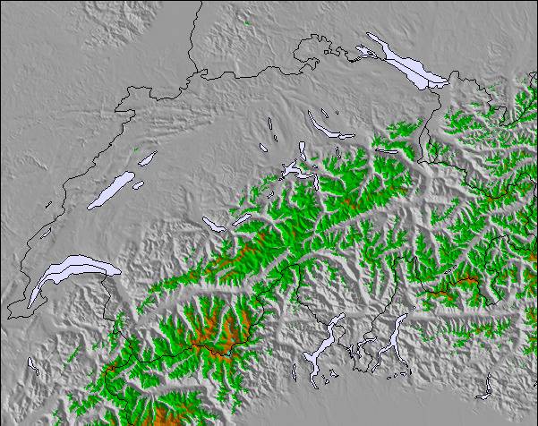
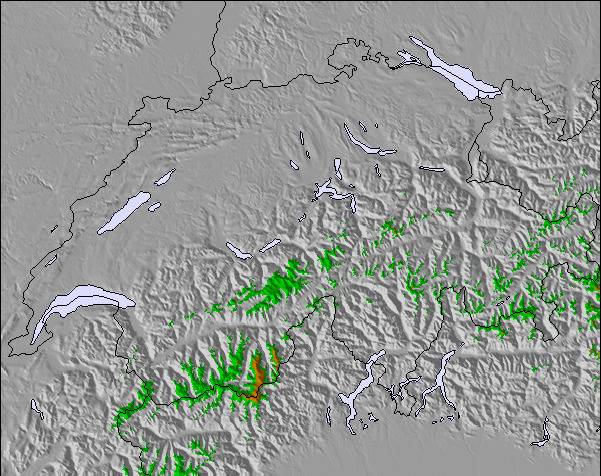
Snow map |  |  |  |  |  |  |  | ||||||||||||||
— | 3 | 8 | — | — | — | — | — | — | — | — | — | — | — | — | — | — | 3 | 1.0 | 1.0 | 1.0 | |
— | — | — | — | — | 1.0 | — | 3 | 4 | — | 4 | 2.0 | — | 4 | 13 | 11 | 6 | 2.0 | — | — | — | |
max°C | 1 | 1 | 1 | 0 | 2 | 2 | 2 | 4 | 3 | 4 | 6 | 6 | 5 | 6 | 6 | 3 | 3 | 3 | 1 | 2 | 2 |
min°C | 1 | 1 | -1 | -1 | 1 | 2 | 2 | 4 | 1 | 3 | 5 | 5 | 5 | 6 | 3 | 2 | 2 | 1 | 1 | 2 | 1 |
-2 | 0 | -5 | -5 | -2 | -1 | 1 | 3 | -1 | 3 | 5 | 3 | 5 | 6 | 1 | -1 | -1 | -3 | -2 | 1 | 1 | |
85 | 98 | 97 | 85 | 81 | 62 | 71 | 81 | 94 | 73 | 74 | 66 | 66 | 80 | 92 | 95 | 90 | 94 | 86 | 94 | 89 | |
2500 | 2500 | 2100 | 2300 | 2550 | 2600 | 2650 | 2800 | 2550 | 2850 | 3050 | 3100 | 3050 | 3200 | 3000 | 2750 | 2850 | 2600 | 2450 | 2650 | 2550 | |
5:48 | — | — | 5:48 | — | — | 5:47 | — | — | 5:45 | — | — | 5:43 | — | — | 5:43 | — | — | 5:41 | — | — | |
— | — | 8:55 | — | — | 8:57 | — | — | 8:58 | — | — | 9:00 | — | — | 9:00 | — | — | 9:01 | — | — | 9:02 | |
Next 0-3 days weather summary:
A light fall of snow, heaviest on Thu night. Turning milder with light rain (total 8.0mm) on Sat afternoon. Freeze-thaw conditions (max 4°C on Sat afternoon, min -1°C on Thu night). Wind will be generally light.
Next 4-6 days weather summary:
Heavy rain (total 42.0mm), heaviest during Tue morning. Later becoming colder with a dusting of snow on Tue night. Mild temperatures (max 6°C on Sun afternoon, min 1°C on Tue night). Wind will be generally light.
Popular Klewenalp - Stockhütte Pages
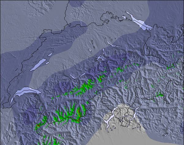
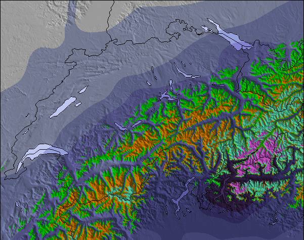
Snow Radar
Latest snow reports near Klewenalp - Stockhütte:
Klewenalp - Stockhütte Snow Conditions
| Top snow depth: | 0 cm |
|---|---|
| Bottom snow depth: | 0 cm |
| Fresh snowfall depth: | — |
| Last snowfall: | 8 May 2024 |
| Snow Alerts | Create Alert |
Other resorts in Switzerland are reporting: powder (1) / good piste (3)
Snow-Forecast Partner Offers
Show your business here
Snow History
Week 3 of May has on average:
0.3 | Bluebird Powder days Fresh snow, mostly sunny, light wind. |
|---|---|
0.4 | Powder days Fresh snow, limited sun, any wind. |
0.1 | Bluebird days Average snow, mostly sunny, light wind. |
Klewenalp - Stockhütte Forecast Snowfall
Other resorts in Switzerland are reporting: powder (1) / good piste (3)
The above table gives the weather forecast for Klewenalp - Stockhütte at the specific elevation of 2324 m. Our sophisticated weather models allow us to provide snow forecasts for the top, middle and bottom ski stations of Klewenalp - Stockhütte. To access the weather forecasts for the other elevations, use the tab navigation above the table. For a wider view of the weather, check out the Weather Map of Switzerland.
Click here to read further information on freezing levels and how we forecast our temperatures.
Resort name is also written as Klewenalp - Stockhutte.
Visitor Reviews of Klewenalp - Stockhütte
Overall 2.9 Based on 4 votes and 1 review
- Snowsure
- Variety of pistes
- Vote
- Matt from Switzerland writes:
Klewenalp (Klewenalp - Stockhütte) is a small resort just south of Luzern. Accessible via cable car or gondola from Stockhutte. Pistes are generally well prepared. There's a wide range of tickets on offer: morning, afternoon, family deals. Suitable for intermediate skiers, though off-piste can be amazing in the right conditions. The staff are friendly and helpful. When I lost my daycard it was replaced, free-of-charge, without question. After Easter, day cards are very cheap. Given good snow, it's an excellent place to visit. I remember one April, skiing in a half meter of powder, for a 20CHF ticket.
Visitor Reviews of Klewenalp - Stockhütte
Matt from Switzerland writes:
Klewenalp (Klewenalp - Stockhütte) is a small resort just south of Luzern. Accessible via cable car or gondola from Stockhutte. Pistes are generally well prepared. There's a wide range of tickets on offer: morning, afternoon, family deals.
Suitable for intermediate skiers, though off-piste can be amazing in the right conditions.
The staff are friendly and helpful. When I lost my daycard it was replaced, free-of-charge, without question.
After Easter, day cards are very cheap. Given good snow, it's an excellent place to visit. I remember one April, skiing in a half meter of powder, for a 20CHF ticket.
Click here to submit your own review of Klewenalp - Stockhütte
Free Snow-Forecast.com weather widget for your website
The Klewenalp - Stockhütte skiing weather widget is available to embed on external websites free of charge. It provides a daily summary of our Klewenalp - Stockhütte snow forecast and current weather conditions. Simply go to the feed configuration page and follow the 3 simple steps to grab the custom html code snippet and paste it into your own site. You can choose the snow forecast elevation (summit, mid-mountain or bottom lift) and metric/imperial units for the snow forecast feed to suit your own website…. Click here to get the code.
View detailed snow forecast for Klewenalp - Stockhütte at:
snow-forecast.com

 Nearest