
Ski Hire by Skiset
extra 5% off

Porté Puymorens Weather (Next 3 days): The snow forecast for Porté Puymorens is: Moderate rain (total 11.0mm) heaviest on Sun afternoon, then becoming colder with a dusting of snow on Mon night. Freeze-thaw conditions (max 4°C on Sat afternoon, min 0°C on Mon night). Wind will be generally light.
Porté Puymorens Weather (Days 4-6): Light rain (total 4.0mm) on Wed afternoon. Becoming colder with heavy fall of snow, heaviest during Thu night. Freeze-thaw conditions (max 3°C on Wed afternoon, min -1°C on Thu night). Wind will be generally light.
| Resort | Snow Depth | Temp. (°C) | Wind (km/h) | Weather | ||
|---|---|---|---|---|---|---|
| Top Lift: | 0.0 m | 3 | ||||
| Middle Lift: | 7 | |||||
| Bottom Lift: | 0.0 m | 11 |
Latest snow reports near Porté Puymorens:
Light rain reported from Urbanització Sa Calma wx at 1270 metres elevation 8 kms SSW of Grandvalira-Canillo but it is forecast cold enough for snow at higher elevations in the ski area from Grandvalira-Canillo

Sat 18 | Sunday 19 | Monday 20 | Tuesday 21 | Wednesday 22 | Thursday 23 | Friday 24 | ||||||||||||||
PM | night | AM | PM | night | AM | PM | night | AM | PM | night | AM | PM | night | AM | PM | night | AM | PM | night | |
rain shwrs | rain shwrs | some clouds | risk thun- der | snow shwrs | clear | light rain | snow shwrs | some clouds | light snow | snow shwrs | snow shwrs | light rain | snow shwrs | light snow | light snow | mod. snow | snow shwrs | snow shwrs | rain shwrs | |
km/h | ||||||||||||||||||||
Snow map |  |  |  |  |  |  |  | |||||||||||||
— | — | — | — | — | — | — | 1.0 | — | 1.0 | 5 | — | — | — | 3 | 5 | 9 | — | — | — | |
2.0 | 1.0 | — | 3 | 2.0 | — | 3 | — | — | 1.0 | — | — | 3 | — | — | — | — | — | 2.0 | 2.0 | |
max°C | 4 | 3 | 3 | 4 | 3 | 2 | 3 | 1 | 1 | 2 | 1 | 0 | 3 | 2 | 1 | 1 | 1 | 0 | 3 | 3 |
min°C | 3 | 1 | 1 | 4 | 1 | 1 | 2 | 0 | 0 | 2 | 0 | 0 | 2 | 0 | 0 | 0 | -1 | 0 | 2 | 2 |
-1 | 0 | -2 | 1 | -2 | -3 | -2 | -3 | -2 | -1 | -4 | -3 | -1 | -4 | -6 | -6 | -5 | -2 | 0 | 0 | |
60 | 82 | 78 | 76 | 89 | 75 | 79 | 73 | 82 | 87 | 97 | 84 | 85 | 84 | 98 | 96 | 87 | 87 | 86 | 64 | |
2900 | 2750 | 2800 | 2900 | 2700 | 2650 | 2750 | 2450 | 2600 | 2700 | 2500 | 2500 | 2800 | 2550 | 2500 | 2600 | 2350 | 2500 | 2800 | 2900 | |
— | — | 6:26 | — | — | 6:24 | — | — | 6:24 | — | — | 6:24 | — | — | 6:22 | — | — | 6:22 | — | — | |
— | 9:10 | — | — | 9:12 | — | — | 9:13 | — | — | 9:14 | — | — | 9:15 | — | — | 9:15 | — | — | 9:16 | |
Moderate rain (total 11.0mm) heaviest on Sun afternoon, then becoming colder with a dusting of snow on Mon night. Freeze-thaw conditions (max 4°C on Sat afternoon, min 0°C on Mon night). Wind will be generally light.
Light rain (total 4.0mm) on Wed afternoon. Becoming colder with heavy fall of snow, heaviest during Thu night. Freeze-thaw conditions (max 3°C on Wed afternoon, min -1°C on Thu night). Wind will be generally light.
Latest snow reports near Porté Puymorens:
Light rain reported from Urbanització Sa Calma wx at 1270 metres elevation 8 kms SSW of Grandvalira-Canillo but it is forecast cold enough for snow at higher elevations in the ski area from Grandvalira-Canillo
| Top snow depth: | 0 cm |
|---|---|
| Bottom snow depth: | 0 cm |
| Fresh snowfall depth: | — |
| Last snowfall: | 7 May 2024 |
| Snow Alerts | Create Alert |
0.2 | Bluebird Powder days Fresh snow, mostly sunny, light wind. |
|---|---|
0.1 | Powder days Fresh snow, limited sun, any wind. |
0.0 | Bluebird days Average snow, mostly sunny, light wind. |
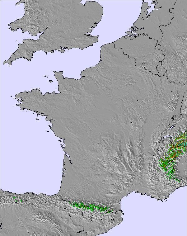
The above table gives the weather forecast for Porté Puymorens at the specific elevation of 2471 m. Our sophisticated weather models allow us to provide snow forecasts for the top, middle and bottom ski stations of Porté Puymorens. To access the weather forecasts for the other elevations, use the tab navigation above the table. For a wider view of the weather, check out the Weather Map of France.
Click here to read further information on freezing levels and how we forecast our temperatures.
Resort name is also written as Porte Puymorens.
Overall 3.3 Based on 5 votes and 1 review
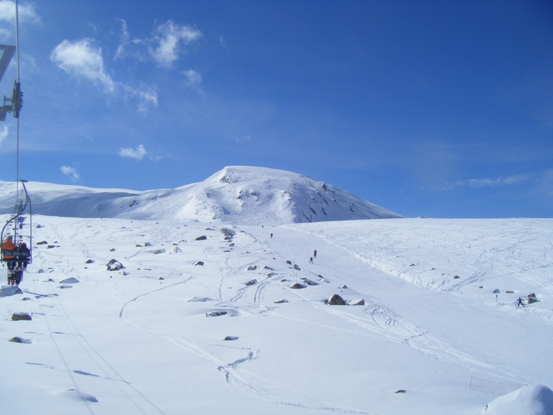
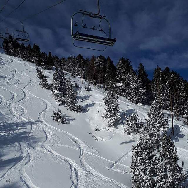
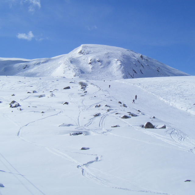
Porte (Porté Puymorens) is a great little station if you don't like crowds. There is plenty of off-piste action and an excellent snowpark. It gets really cold (n/nw facing) so wrap up warm! One of my favourite places to go boarding 'though don't expect high class food! The cafeteria is adequate at best.
Shaun McGuinness from France writes:
Porte (Porté Puymorens) is a great little station if you don't like crowds. There is plenty of off-piste action and an excellent snowpark. It gets really cold (n/nw facing) so wrap up warm! One of my favourite places to go boarding 'though don't expect high class food! The cafeteria is adequate at best.
The Porté Puymorens skiing weather widget is available to embed on external websites free of charge. It provides a daily summary of our Porté Puymorens snow forecast and current weather conditions. Simply go to the feed configuration page and follow the 3 simple steps to grab the custom html code snippet and paste it into your own site. You can choose the snow forecast elevation (summit, mid-mountain or bottom lift) and metric/imperial units for the snow forecast feed to suit your own website…. Click here to get the code.
View detailed snow forecast for Porté Puymorens at:
snow-forecast.com


 Nearest