


View forecast
Unterwasser - Toggenburg at 2627 m altitude
Issued by Snow-Forecast.com at: 7 pm (local time) / 03 May 2024
Now
Saturday 4 | Sunday 5 | Monday 6 | Tuesday 7 | Wednesday 8 | Thursday 9 | ||||||||||||||
night | AM | PM | night | AM | PM | night | AM | PM | night | AM | PM | night | AM | PM | night | AM | PM | night | |
light snow | cloudy | light snow | light snow | cloudy | snow shwrs | some clouds | some clouds | light snow | mod. snow | light snow | light snow | cloudy | cloudy | light snow | snow shwrs | clear | clear | clear | |
km/h | |||||||||||||||||||
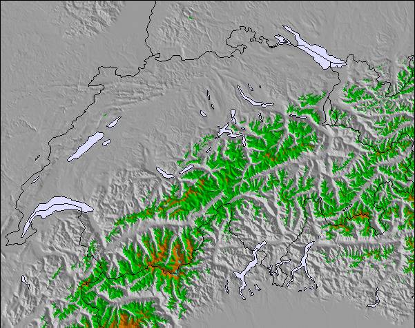
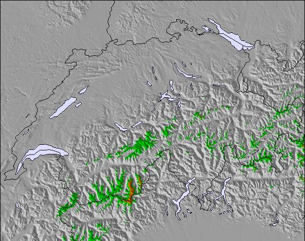
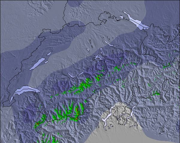
Snow map |  |  |  |  |  |  |  | ||||||||||||
— | — | — | — | — | — | — | — | 1.0 | 6 | 2.0 | — | — | — | — | — | — | — | — | |
— | — | — | — | — | 1.0 | — | — | — | — | — | — | — | — | — | — | — | — | — | |
max°C | -4 | -2 | 0 | 1 | 0 | 2 | 3 | 2 | 2 | 0 | -3 | -3 | -2 | -2 | -1 | 1 | 1 | 3 | 4 |
min°C | -4 | -3 | -1 | -1 | 0 | 0 | 2 | 2 | 1 | -3 | -3 | -3 | -3 | -3 | -1 | -1 | 1 | 3 | 3 |
-6 | -7 | -5 | -4 | -5 | -5 | -1 | -1 | -2 | -8 | -6 | -3 | -3 | -7 | -4 | -4 | -4 | -1 | 0 | |
89 | 77 | 82 | 64 | 88 | 77 | 61 | 74 | 98 | 97 | 98 | 96 | 98 | 96 | 95 | 67 | 32 | 28 | 23 | |
1900 | 2350 | 2600 | 2750 | 2650 | 2950 | 3100 | 2900 | 2850 | 2200 | 2050 | 2150 | 2150 | 2300 | 2450 | 2650 | 3100 | 3200 | 3400 | |
— | 6:01 | — | — | 6:00 | — | — | 5:58 | — | — | 5:56 | — | — | 5:54 | — | — | 5:54 | — | — | |
— | — | — | 8:37 | — | — | 8:38 | — | — | 8:40 | — | — | 8:42 | — | — | 8:43 | — | — | 8:45 | |
Next 0-3 days weather summary:
Drizzle at first, then turning colder with dusting of snow on Mon afternoon. Freeze-thaw conditions (max 3°C on Sun night, min -4°C on Fri night). Wind will be generally light.
Next 4-6 days weather summary:
A light covering of new snow, mostly falling on Mon night. Freeze-thaw conditions (max 3°C on Thu afternoon, min -3°C on Mon night). Wind will be generally light.
Popular Unterwasser - Toggenburg Pages
Snow Radar
Submit a reportLatest snow reports near Unterwasser - Toggenburg:
44 km away from Unterwasser - Toggenburg
10 hours ago
Rain reported from Brand at 1032 metres elevation 9 kms W of Golm but it is forecast cold enough for snow at the ski area from Golm
32 km away from Unterwasser - Toggenburg
12 hours agoRain reported from Feldkirch at 440 metres elevation 9 kms WSW of Laternser Tal but it is forecast cold enough for snow at higher elevations in the ski area from Laternser Tal
Unterwasser - Toggenburg Snow Conditions
| Top snow depth: | — |
|---|---|
| Bottom snow depth: | — |
| Fresh snowfall depth: | 3 cm |
| Last snowfall: | 2 May 2024 |
| Snow Alerts | Create Alert |
Other resorts in Switzerland are reporting: powder (2) / good piste (2)
Snow-Forecast Partner Offers
Show your business here
Snow History
Week 1 of May has on average:
0.6 | Bluebird Powder days Fresh snow, mostly sunny, light wind. |
|---|---|
2.2 | Powder days Fresh snow, limited sun, any wind. |
0.4 | Bluebird days Average snow, mostly sunny, light wind. |

Unterwasser - Toggenburg Forecast Snowfall
Other resorts in Switzerland are reporting: powder (2) / good piste (2)
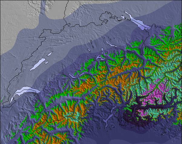
The above table gives the weather forecast for Unterwasser - Toggenburg at the specific elevation of 2627 m. Our sophisticated weather models allow us to provide snow forecasts for the top, middle and bottom ski stations of Unterwasser - Toggenburg. To access the weather forecasts for the other elevations, use the tab navigation above the table. For a wider view of the weather, check out the Weather Map of Switzerland.
Click here to read further information on freezing levels and how we forecast our temperatures.
Visitor Reviews of Unterwasser - Toggenburg
- chris copsey from United Kingdom writes:
Thank you Unter Wasser for 6 fantastic days in your village. The skiing was out of this world and the facilities superb! We met so many lovely local people who were so friendly and proud of the resort. We will always have a dream to return to to your special part of our planet! The Copsey Family xxxx
Visitor Reviews of Unterwasser - Toggenburg
chris copsey from United Kingdom writes:
Thank you Unter Wasser for 6 fantastic days in your village. The skiing was out of this world and the facilities superb! We met so many lovely local people who were so friendly and proud of the resort. We will always have a dream to return to to your special part of our planet!
The Copsey Family xxxx
Click here to submit your own review of Unterwasser - Toggenburg
Free Snow-Forecast.com weather widget for your website
The Unterwasser - Toggenburg skiing weather widget is available to embed on external websites free of charge. It provides a daily summary of our Unterwasser - Toggenburg snow forecast and current weather conditions. Simply go to the feed configuration page and follow the 3 simple steps to grab the custom html code snippet and paste it into your own site. You can choose the snow forecast elevation (summit, mid-mountain or bottom lift) and metric/imperial units for the snow forecast feed to suit your own website…. Click here to get the code.
View detailed snow forecast for Unterwasser - Toggenburg at:
snow-forecast.com

 Nearest