
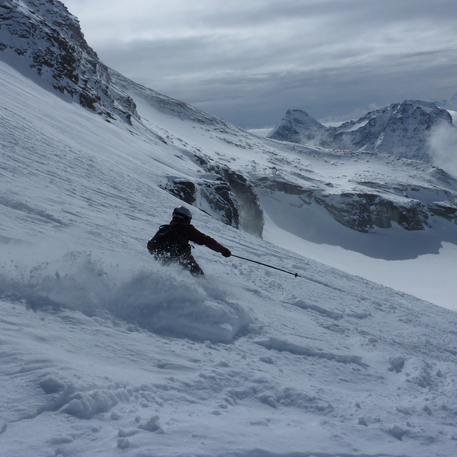
Solitude Sets Record-Breaking Season With 178 Days of Skiing
Updated April 30, 2025: North America holds strong with over 30 ski areas still spinning lifts—snowy peaks in the West, deep bases in the Midwest, and sunny spring turns coast to coast.
Please sign in with your Snow-Forecast account details below.
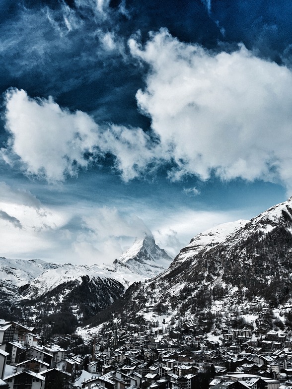

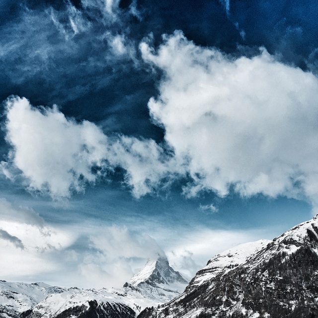
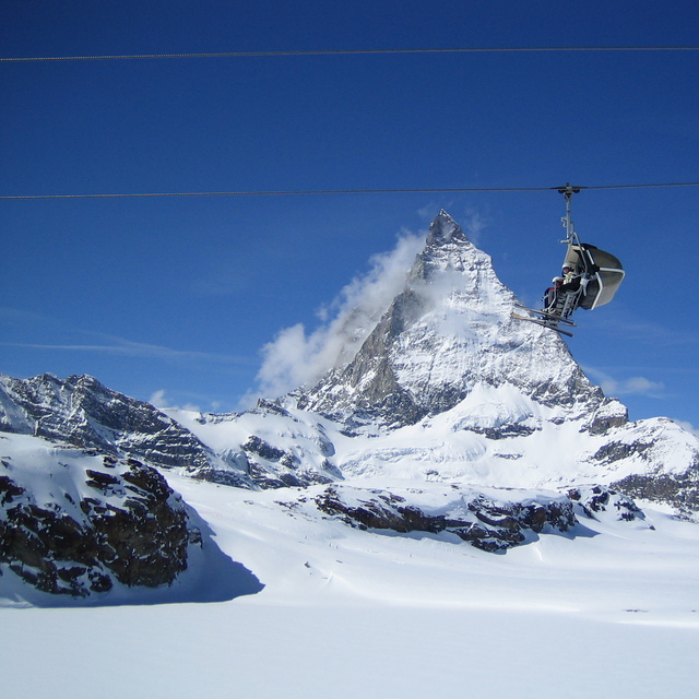
Zermatt Weather (Next 3 days): The snow forecast for Zermatt is: Heavy rain (total 26.0mm), heaviest during Sun afternoon. Mild temperatures (max 7°C on Fri afternoon, min 3°C on Sat night). Wind will be generally light.
Zermatt Weather (Days 4-6): A heavy fall of snow, heaviest during Sun night. Freeze-thaw conditions (max 1°C on Sun night, min -5°C on Mon night). Wind will be generally light.
| Resort | Snow Depth | Temp. (°C) | Wind (km/h) | Weather | ||
|---|---|---|---|---|---|---|
| Top Lift: | 1.1 m | -3 | ||||
| Middle Lift: | 5 | |||||
| Bottom Lift: | 0.1 m | 11 |
Latest snow reports near Zermatt:

Friday 2 | Saturday 3 | Sunday 4 | Monday 5 | Tuesday 6 | Wednesday 7 | ||||||||||||||
night | AM | PM | night | AM | PM | night | AM | PM | night | AM | PM | night | AM | PM | night | AM | PM | night | |
rain shwrs | clear | rain shwrs | rain shwrs | some clouds | light rain | rain shwrs | light rain | mod. rain | heavy snow | light snow | light snow | light snow | light snow | light snow | mod. snow | some clouds | light snow | snow shwrs | |
km/h | |||||||||||||||||||
Snow map |  |  |  |  |  |  |  | ||||||||||||
— | — | — | — | — | — | — | — | — | 11 | — | 1.0 | 1.0 | — | 4 | 7 | — | 1.0 | — | |
1.0 | — | 1.0 | 1.0 | — | 5 | 7 | 1.0 | 10 | — | — | — | — | — | — | — | — | — | — | |
max°C | 5 | 6 | 7 | 6 | 5 | 6 | 5 | 4 | 3 | 1 | -2 | -2 | -3 | -2 | -1 | -2 | -3 | -2 | -2 |
min°C | 4 | 4 | 7 | 4 | 4 | 6 | 3 | 3 | 3 | -2 | -2 | -2 | -5 | -4 | -1 | -4 | -4 | -2 | -4 |
4 | 4 | 7 | 2 | 3 | 4 | 1 | 1 | 0 | -5 | -6 | -5 | -5 | -4 | -1 | -4 | -4 | -5 | -7 | |
67 | 39 | 68 | 65 | 77 | 73 | 73 | 69 | 99 | 99 | 98 | 96 | 96 | 92 | 98 | 97 | 92 | 86 | 69 | |
3350 | 3550 | 3700 | 3450 | 3450 | 3500 | 3250 | 3350 | 3100 | 2450 | 2400 | 2450 | 1900 | 2400 | 2500 | 2050 | 2350 | 2450 | 1850 | |
— | 6:15 | — | — | 6:13 | — | — | 6:11 | — | — | 6:09 | — | — | 6:09 | — | — | 6:07 | — | — | |
— | — | — | 8:37 | — | — | 8:37 | — | — | 8:39 | — | — | 8:40 | — | — | 8:42 | — | — | 8:43 | |
Heavy rain (total 26.0mm), heaviest during Sun afternoon. Mild temperatures (max 7°C on Fri afternoon, min 3°C on Sat night). Wind will be generally light.
A heavy fall of snow, heaviest during Sun night. Freeze-thaw conditions (max 1°C on Sun night, min -5°C on Mon night). Wind will be generally light.
Latest snow reports near Zermatt:
| Top snow depth: | 105 cm |
|---|---|
| Bottom snow depth: | 10 cm |
| Fresh snowfall depth: | — |
| Last snowfall: | 27 Apr 2025 |
| Snow Alerts | Create Alert |
1.0 | Bluebird Powder days Fresh snow, mostly sunny, light wind. |
|---|---|
2.3 | Powder days Fresh snow, limited sun, any wind. |
0.4 | Bluebird days Average snow, mostly sunny, light wind. |
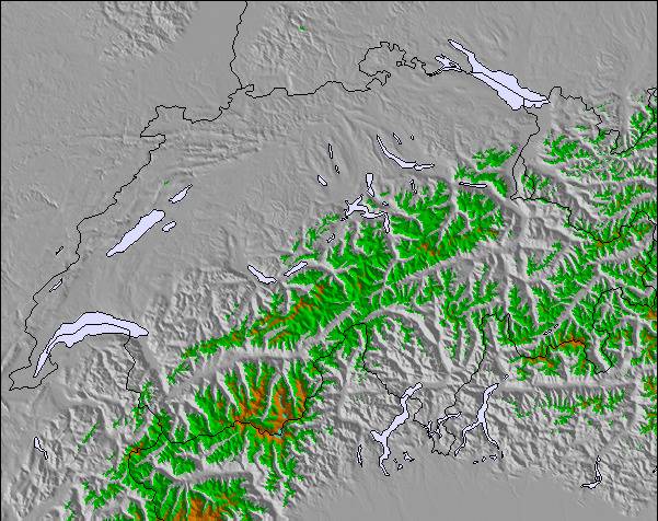
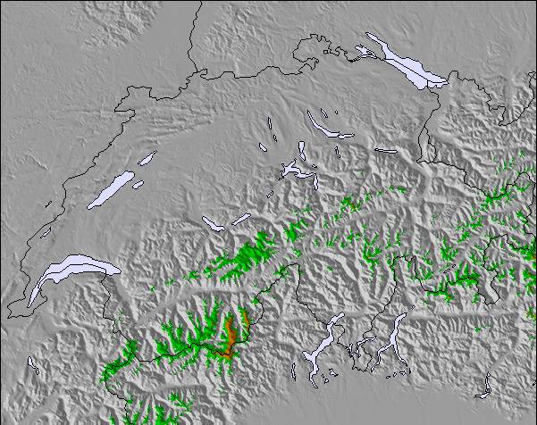
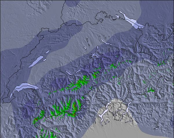
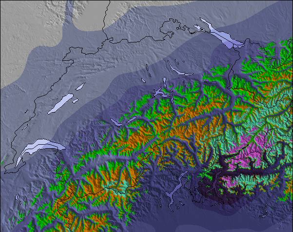
The above table gives the weather forecast for Zermatt at the specific elevation of 2720 m. Our sophisticated weather models allow us to provide snow forecasts for the top, middle and bottom ski stations of Zermatt. To access the weather forecasts for the other elevations, use the tab navigation above the table. For a wider view of the weather, check out the Weather Map of Switzerland.
Click here to read further information on freezing levels and how we forecast our temperatures.
Overall 4.1 Based on 81 votes and 72 reviews
C'est tellement nul de devoir skier pendant quatre jours dans un petit domaine limité alors qu'il y a en fait un immense domaine. On aurait bien pu ouvrir, entre autres, les descentes de Riffelberg à Furi et de Riffelberg à Riffelalp. Les dameuses étaient finalement beaucoup en route et en train de préparer les pistes. Simplement très mal coordonnées, ou alors on ne voulait pas vraiment ouvrir, mais économiser sur les skieurs.... Alors que les Autrichiens ouvrent toutes leurs remontées tous les matins, qu'il neige, qu'il y ait de la tempête ou du brouillard, les Zermattois ouvrent d'abord une petite partie de leurs remontées. Si l'on a de la chance, un ou deux viennent s'ajouter l'après-midi, si l'on n'a pas de chance, il n'y en a plus du tout. C'est ce qui s'est passé pour nous pendant les quatre jours que nous avons passés là-bas, du 9 au 12 décembre 2012. Chez nous, du côté de Zermatt, seules 15 remontées mécaniques sur 54 étaient ouvertes pendant les quatre jours. Même s'il y avait du vent au col vers l'Italie, on aurait pu ouvrir plus de remontées et de descentes du côté de Zermatt, à l'abri du vent, pour ne pas énerver les clients. Et puis le prix à débourser pour 4 jours : 316 € pour 15 remontées ouvertes à Zermatt. En comparaison, pour la même période du 08 au 12 décembre : 189 € pour 31 remontées ouvertes à Ischgl. 137 € de différence ! Jusqu'à présent, j'ai skié à plusieurs reprises dans le Kaunertal, Ischgl, Kappl, Galtür, Ötztal, Zillertal, Kitzbühel, Warth-Schröcken, Damüls, Lech et Oberstdorf. Partout, ils ouvrent d'abord toutes les remontées mécaniques le matin. S'il y a beaucoup de vent, il arrive que l'une ou l'autre cabine soit brièvement arrêtée jusqu'à ce que la bourrasque se calme. Mais Zermatt est très différent - on n'ouvre que quelques remontées le matin et on attend de voir si les remontées sont pleines. Ce n'est pas possible pour une station aussi réputée ! Ce n'est que du vent ! De plus, s'ils étaient honnêtes, ils avoueraient que l'offre de descentes va du bleu au rouge clair - il n'y a pas un seul défi pour les bons skieurs. Comme les Zermattois sont si snobs, ils ont aussi une gestion des plaintes nulle. Je me suis plaint deux fois auprès du CEO et de la directrice du marketing, mais je n'ai reçu aucune réponse. Tant pis pour Zermatt - les riches y sont plus importants que le reste du peuple !
Serge from France writes:
C'est tellement nul de devoir skier pendant quatre jours dans un petit domaine limité alors qu'il y a en fait un immense domaine. On aurait bien pu ouvrir, entre autres, les descentes de Riffelberg à Furi et de Riffelberg à Riffelalp. Les dameuses étaient finalement beaucoup en route et en train de préparer les pistes.
Simplement très mal coordonnées, ou alors on ne voulait pas vraiment ouvrir, mais économiser sur les skieurs....
Alors que les Autrichiens ouvrent toutes leurs remontées tous les matins, qu'il neige, qu'il y ait de la tempête ou du brouillard, les Zermattois ouvrent d'abord une petite partie de leurs remontées. Si l'on a de la chance, un ou deux viennent s'ajouter l'après-midi, si l'on n'a pas de chance, il n'y en a plus du tout.
C'est ce qui s'est passé pour nous pendant les quatre jours que nous avons passés là-bas, du 9 au 12 décembre 2012.
Chez nous, du côté de Zermatt, seules 15 remontées mécaniques sur 54 étaient ouvertes pendant les quatre jours.
Même s'il y avait du vent au col vers l'Italie, on aurait pu ouvrir plus de remontées et de descentes du côté de Zermatt, à l'abri du vent, pour ne pas énerver les clients.
Et puis le prix à débourser pour 4 jours : 316 € pour 15 remontées ouvertes à Zermatt.
En comparaison, pour la même période du 08 au 12 décembre : 189 € pour 31 remontées ouvertes à Ischgl.
137 € de différence !
Jusqu'à présent, j'ai skié à plusieurs reprises dans le Kaunertal, Ischgl, Kappl, Galtür, Ötztal, Zillertal, Kitzbühel, Warth-Schröcken, Damüls, Lech et Oberstdorf.
Partout, ils ouvrent d'abord toutes les remontées mécaniques le matin. S'il y a beaucoup de vent, il arrive que l'une ou l'autre cabine soit brièvement arrêtée jusqu'à ce que la bourrasque se calme.
Mais Zermatt est très différent - on n'ouvre que quelques remontées le matin et on attend de voir si les remontées sont pleines.
Ce n'est pas possible pour une station aussi réputée !
Ce n'est que du vent !
De plus, s'ils étaient honnêtes, ils avoueraient que l'offre de descentes va du bleu au rouge clair - il n'y a pas un seul défi pour les bons skieurs.
Comme les Zermattois sont si snobs, ils ont aussi une gestion des plaintes nulle. Je me suis plaint deux fois auprès du CEO et de la directrice du marketing, mais je n'ai reçu aucune réponse.
Tant pis pour Zermatt - les riches y sont plus importants que le reste du peuple !
The Zermatt skiing weather widget is available to embed on external websites free of charge. It provides a daily summary of our Zermatt snow forecast and current weather conditions. Simply go to the feed configuration page and follow the 3 simple steps to grab the custom html code snippet and paste it into your own site. You can choose the snow forecast elevation (summit, mid-mountain or bottom lift) and metric/imperial units for the snow forecast feed to suit your own website…. Click here to get the code.
View detailed snow forecast for Zermatt at:
snow-forecast.com

 Nearest